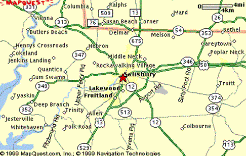
FROM DELAWARE AND POINTS NORTH OF SALISBURY
South on State Route 13 past the Maryland State Police Barracks (on your left). Right (at Lowes) on Naylor Mill
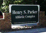
Road (State Route 431) after approximately 1.3 miles, right at the Henry S. Parker (Wicomico County) Athletic Complex entrance
(intersection of Naylor Mill Road and Scenic Drive).
FROM THE VIRGINIA PORTION OF THE DELMARVA PENINSULA AND POINTS
SOUTH OF SALISBURY
North on State Route 13 through the central section of Salisbury over U. S. Route 50 (Ocean Gateway). Left (at
Lowes) on Naylor Mill Road (State Route 431) after approximately 1.3 miles, right at the Henry S. Parker (Wicomico County)
Athletic Complex entrance (intersection of Naylor Mill road and Scenic Drive).
FROM OCEAN CITY AND POINTS EAST OF SALISBURY
West on U. S. Route 50 (The Ocean Gateway) pass Perdue Stadium (on your left), right (north) onto the State Route 13
BYPASS merge into State Route 13 BUSINESS (The Center at Salisbury Mall on your right) left on Naylor Mill Road (State
Route 431) after approximately 1.3 miles right at the Henry S. Parker (Wicomico County) Athletic Complex entrance (intersection
of Naylor Mill Road and Scenic Drive).
FROM CAMBRIDGE AND POINTS WEST OF SALSIBURY
East on U. S. Route 50 (The
Ocean Gateway) past Springhill Memorial Gardens (on your left) then left on Naylor Mill Road (State Route 431) approximately
2 miles left at the Henry S. Parker (Wicomico County) Athletic Complex entrance (intersection of Naylor Mill Road and Scenic
Drive).